By cuterose
Derbyshire flooding as water levels expected to keep rising
Parts of Derbyshire have flooded as the county prepares for more rain and rising water levels.
The Environment Agency has issued nine flood warnings in the county - meaning flooding is expected - and water levels are expected to peak this evening.
The flooding comes as Storm Franklin is due to bring strong rain and heavy winds to the UK from Sunday, following disruption left by Storm Eunice.
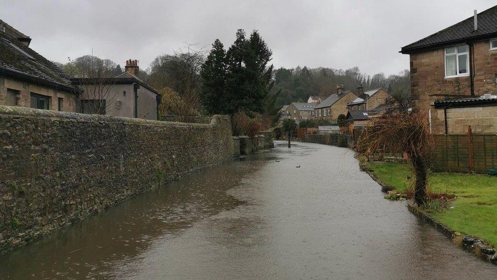
Parts of Bakewell were flooded and people have been putting out sandbags.
Derbyshire Dales District Council said there were sandbagging points in Litton, Bakewell, Rowsley, Darley Bridge, Matlock, Matlock Bath and Cromford.
Paul Reeves, from the Environment Agency, said river levels are set to increase along the whole of the River Derwent in Derbyshire over the next 24 hours.
Bakewell stall market is cancelled on Monday due to flooding and the forecast for high winds.
Darley Bridge on The River Derwent was closed on Sunday due to rising river levels, and Derbyshire Police asked people to avoid the area and respect any road closure signs.

Here's the River Derwent at #DarleyBridge filmed by our #flood response team. Bridge now closed.1 of 7 #FloodWarnings issued so far today here in the Dales by the @EnvAgencyMore info👇https://t.co/cXqJJdUehc#StaySafe pic.twitter.com/xOpDYK6VTg
— Derbyshire Dales DC (@derbyshiredales) February 20, 2022The BBC is not responsible for the content of external sites.View original tweet on TwitterThe flood warnings in the county are in place for the River Wye at Ashford in the Water and Bakewell, and the River Derwent at Bamford, Grindleford, Hathersage, Chatsworth, Darley Dale and Calver, and the River Goyt at Whaley Bridge.
The Government website showed water levels on the River Derwent at Chatsworth to be 4.02m at 14:00 GMT on Sunday, with the levels expected to peak at 4.77m at about 20:45.
The highest water level recorded at this measuring station was 5.17m in November 2019.
At Derby Rugby Club, about 30 volunteers spent Sunday morning putting wire fencing around the pitch and heavy weights on the edge of it to prevent it being lifted by flood water, which wasexpected in the evening.
Mathew Gable from the Environment Agency said they were monitoring river levels.
He said: "While we still think there will be some property flooding, thankfully we don't think it will be quite as bad as it was in 2019."
In 2019, former Derbyshire High Sheriff Annie Hall was swept to her death by a flooded river near Matlock.
Mr Gable said they believe it will be "more akin to what happened in 2021".
Derbyshire County Council said the heavy rain had closed a number of roads in the county including A57 Ladybower to Glossop and the A6 at Buxton.
Follow BBC East Midlands on Facebook, Twitter, or Instagram. Send your story ideas to eastmidsnews@bbc.co.uk.
Related Articles

What devices work with Apple Fitness Plus? Here's what's compatible with Apple's workout app
Amazon Halo Review: The Fitness Gadget We Don’t Deserve or Need
Redmi Watch 2 Lite with over 100 fitness modes, heart rate tracker launched for Rs 4,999
Fitbit Sense review: A premium wearable that rivals the likes of Apple and Samsung Register for free to continue reading


